LiDAR (Light Detection and Ranging) and photogrammetry are two essential technologies used in various applications, especially in drone survey missions. While both are used to create three-dimensional representations of the Earth’s surface, they operate on different principles and have unique strengths and weaknesses. This part of the article will introduce both technologies, setting the stage for a detailed comparison to help readers understand which method might be best suited for their specific needs.
What is Photogrammetry?
Photogrammetry is a technique that uses photographs to measure the environment. By capturing a large number of high-resolution photos over an area, with overlapping images showing the same point on the ground from different vantage points, a 3D map can be generated.
The human brain uses information from both eyes to provide depth perception, and photogrammetry uses a similar concept. It combines images containing the same point on the ground from multiple angles to yield detailed 2D and 3D maps. The result is a high-resolution 3D reconstruction that includes elevation, texture, shape, and color for every point on the map, enabling easier interpretation of the resulting 3D point cloud.
Drone systems that utilize photogrammetry are cost-effective and provide outstanding flexibility in terms of where, when, and how 2D and 3D data are captured.
What is LiDAR?
LiDAR, standing for “light detection and ranging,” is a remote sensing technology that uses laser light to measure distances and create 3D representations of the target area. It sends out pulses of laser light and measures the exact time it takes for these pulses to return as they bounce from the ground, along with the intensity of that reflection.
LiDAR has been around for many decades but has only recently become feasible for use on large drones. It uses oscillating mirrors to send out laser pulses in many directions, generating a “sheet” of light as the drone moves forward. By measuring the timing and intensity of the returning pulses, it can provide readings of the terrain and points on the ground.
The sensor itself is only one part of a LiDAR system. Other critical components include a high-precision satellite positioning system (GNSS) and high-accuracy sensors to determine the orientation of the LiDAR sensor in space—an inertial measurement unit (IMU). All of these subsystems must work in perfect orchestration to enable the processing of raw data into usable information.
LiDAR is available in two types: classical manned airborne and lightweight UAV. The former covers more ground but is less accurate, while the latter can be more precise.
Applications of Photogrammetry
Real Estate
Photogrammetry is invaluable in real estate, where it’s used to create detailed 3D visualizations of properties. These visualizations offer potential buyers a virtual tour experience, allowing them to explore properties remotely, making property listings more interactive and engaging.
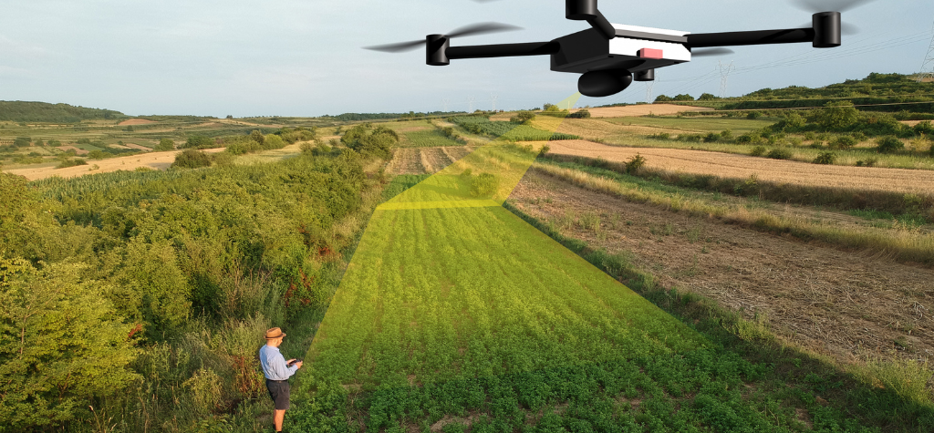
Agriculture
In agriculture, photogrammetry aids in monitoring crop health, assessing land, and planning agricultural operations based on detailed aerial imagery. It can help detect areas of stress in crops, optimize irrigation, and even assist in predicting yields.
Archaeology
Archaeologists use photogrammetry to document and preserve historical sites. By creating a permanent digital record of artifacts and structures, they can study and analyze these sites without physically disturbing them. This is especially useful for sites that are fragile or at risk of degradation.
Urban Planning
City planners and architects employ photogrammetry to design and model urban environments. This aids in infrastructure development, cityscape visualization, and even traffic planning. It provides a bird’s-eye view of urban areas, helping in efficient space utilization and planning.
Applications of LiDAR
Industrial and Construction Applications
Envision LiDAR as the digital backbone of modern construction, diligently overseeing sites and infrastructures. It crafts intricate 3D visualizations that monitor advancements, guarantee accuracy, and highlight discrepancies from original designs. With these dynamic digital maps, architects, engineers, and site supervisors ensure seamless project execution, sidestepping unexpected expenses. LiDAR’s laser precision acts as the vigilant sentinel, ensuring every brick and beam aligns perfectly. Integrating with platforms like RENDR amplifies its capabilities, offering a holistic view and streamlined management of construction endeavors.
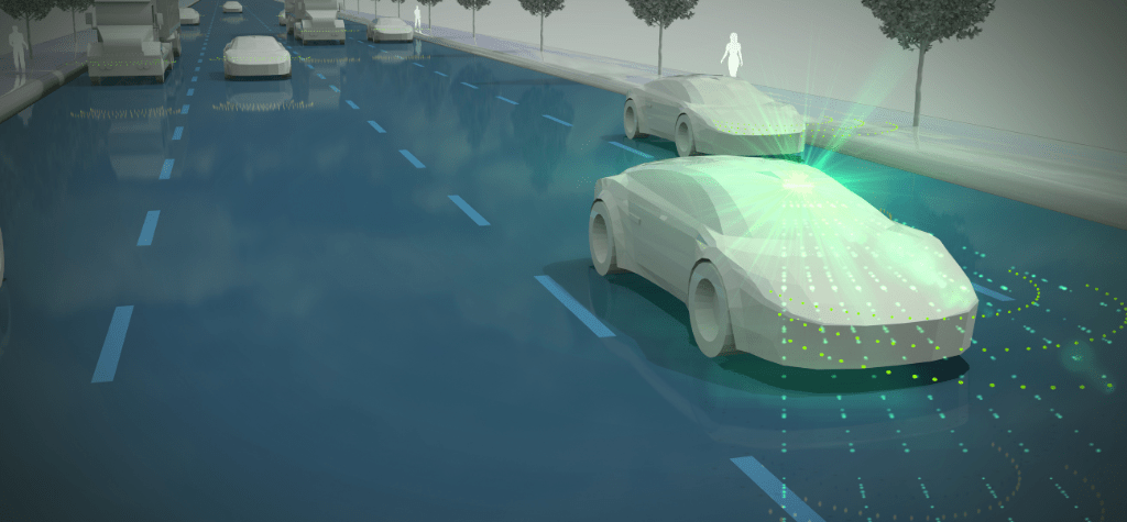
Autonomous Vehicles
Modern self-driving cars use LiDAR systems to navigate and detect obstacles. The high-resolution 3D mapping provided by LiDAR is crucial for the safe operation of these vehicles.
Archeology and Forestry
LiDAR’s ability to penetrate dense vegetation makes it perfect for assessing forest density, health, and biomass estimation. It can provide detailed canopy structures, helping in forest management and conservation efforts.
Topographical Mapping
For creating detailed elevation maps, especially in terrains with dense vegetation or overgrowth, LiDAR is unparalleled.
Strengths and Weaknesses
Photogrammetry Strengths:
- Cost-effective: Photogrammetry, especially when using drones, is generally more affordable than LiDAR, making it accessible for smaller projects.
- Detailed Imagery: It captures the real-world textures and colors, providing life-like representations, including orthomosaics and 3D models.
- Flexibility: Suitable for a diverse range of applications from agriculture to urban planning.
Photogrammetry Weaknesses:
- Lighting Conditions: Photogrammetry requires optimal lighting conditions for accurate results, making it susceptible to time-of-day and weather constraints.
- Dense Vegetation: It struggles to penetrate thick canopies, making it less accurate in forested areas.
- Processing Time: The need to stitch together overlapping images means that photogrammetry can require significant processing time.
LiDAR Strengths:
- High Accuracy: LiDAR offers unparalleled precision in capturing both horizontal and vertical data.
- Vegetation Penetration: Its ability to penetrate dense vegetation makes it ideal for forestry and overgrown terrains.
- Quick Data Collection: LiDAR systems can rapidly cover large areas, providing quick results.
LiDAR Weaknesses:
- Cost: High-end LiDAR systems can be expensive, making them less accessible for smaller projects.
- Color Information: LiDAR does not capture the real-world appearance in terms of colors and textures.
- Specialized Equipment: LiDAR requires specific equipment and expertise, making it less accessible than photogrammetry for some users.
| Feature | LiDAR | Photogrammetry |
| Accuracy | Very high relative and absolute accuracy, usually within centimeters | Harder to achieve absolute accuracy, but has very high relative accuracy |
| Range | Medium to long distances (hundreds of meters to kilometers) | Short to medium distances (tens to hundreds of meters) |
| 3D Mapping | Detailed 3D mapping capabilities | Detailed 3D models with texture and color |
| Leaf Penetration | LiDAR can penetrate between the gaps in branches and leaves to reach the ground | Photogrammetry can not penetrate through leaves and vegetation greatly decreases accuracy |
| Cost | Much higher cost due to the complexity | Generally more affordable and less complex |
| Application | Forestry, contracting, aerial mapping, autonomous vehicles | Agriculture, urban planning, bare-earth mining |
| Limiations | LiDAR cannot penetrate clouds and does not operate effectively in rain, fog or snow | Photogrammetry can not operate without proper sunlight |
Conclusion
The detailed comparison between LiDAR and photogrammetry has illuminated the intricate nuances that differentiate these two vital technologies. While both serve the purpose of creating 3D representations of the Earth’s surface, their methodologies, applications, accuracies, and costs vary significantly.
LiDAR, with its laser-based technology, offers unparalleled precision in capturing elevation data and the ability to penetrate dense vegetation. Its applications in topographical mapping, mining, and infrastructure inspection demonstrate its robust capabilities, especially in complex terrains.
Photogrammetry, on the other hand, excels in capturing real-world textures and colors, providing life-like representations. Its cost-effectiveness and accessibility make it a preferred choice for various industries, including real estate, agriculture, and smaller-scale mapping projects.
Ultimately, the comparison between LiDAR and photogrammetry underscores the importance of understanding the strengths and weaknesses of each technology. Professionals must align their choices with their project goals, recognizing that each technology may be more suitable for different scenarios. The insights provided in this analysis aim to equip readers with the knowledge to make informed decisions, leveraging the best of what both LiDAR and photogrammetry have to offer.
LiDAR (Light Detection and Ranging) and photogrammetry are two essential technologies used in various applications, especially in drone survey missions. While both are used to create three-dimensional representations of the Earth’s surface, they operate on different principles and have unique strengths and weaknesses. This part of the article will introduce both technologies, setting the stage for a detailed comparison to help readers understand which method might be best suited for their specific needs.
What is Photogrammetry?
Photogrammetry is a technique that uses photographs to measure the environment. By capturing a large number of high-resolution photos over an area, with overlapping images showing the same point on the ground from different vantage points, a 3D map can be generated.
The human brain uses information from both eyes to provide depth perception, and photogrammetry uses a similar concept. It combines images containing the same point on the ground from multiple angles to yield detailed 2D and 3D maps. The result is a high-resolution 3D reconstruction that includes elevation, texture, shape, and color for every point on the map, enabling easier interpretation of the resulting 3D point cloud.
Drone systems that utilize photogrammetry are cost-effective and provide outstanding flexibility in terms of where, when, and how 2D and 3D data are captured.
What is LiDAR?
LiDAR, standing for “light detection and ranging,” is a remote sensing technology that uses laser light to measure distances and create 3D representations of the target area. It sends out pulses of laser light and measures the exact time it takes for these pulses to return as they bounce from the ground, along with the intensity of that reflection.
LiDAR has been around for many decades but has only recently become feasible for use on large drones. It uses oscillating mirrors to send out laser pulses in many directions, generating a “sheet” of light as the drone moves forward. By measuring the timing and intensity of the returning pulses, it can provide readings of the terrain and points on the ground.
The sensor itself is only one part of a LiDAR system. Other critical components include a high-precision satellite positioning system (GNSS) and high-accuracy sensors to determine the orientation of the LiDAR sensor in space—an inertial measurement unit (IMU). All of these subsystems must work in perfect orchestration to enable the processing of raw data into usable information.
LiDAR is available in two types: classical manned airborne and lightweight UAV. The former covers more ground but is less accurate, while the latter can be more precise.
Applications of Photogrammetry
Real Estate
Photogrammetry is invaluable in real estate, where it’s used to create detailed 3D visualizations of properties. These visualizations offer potential buyers a virtual tour experience, allowing them to explore properties remotely, making property listings more interactive and engaging.
Agriculture
In agriculture, photogrammetry aids in monitoring crop health, assessing land, and planning agricultural operations based on detailed aerial imagery. It can help detect areas of stress in crops, optimize irrigation, and even assist in predicting yields.
Archaeology
Archaeologists use photogrammetry to document and preserve historical sites. By creating a permanent digital record of artifacts and structures, they can study and analyze these sites without physically disturbing them. This is especially useful for sites that are fragile or at risk of degradation.
Urban Planning
City planners and architects employ photogrammetry to design and model urban environments. This aids in infrastructure development, cityscape visualization, and even traffic planning. It provides a bird’s-eye view of urban areas, helping in efficient space utilization and planning.
Applications of LiDAR
Industrial and Construction Applications
Envision LiDAR as the digital backbone of modern construction, diligently overseeing sites and infrastructures. It crafts intricate 3D visualizations that monitor advancements, guarantee accuracy, and highlight discrepancies from original designs. With these dynamic digital maps, architects, engineers, and site supervisors ensure seamless project execution, sidestepping unexpected expenses. LiDAR’s laser precision acts as the vigilant sentinel, ensuring every brick and beam aligns perfectly. Integrating with platforms like RENDR amplifies its capabilities, offering a holistic view and streamlined management of construction endeavors.
Autonomous Vehicles
Modern self-driving cars use LiDAR systems to navigate and detect obstacles. The high-resolution 3D mapping provided by LiDAR is crucial for the safe operation of these vehicles.
Archeology and Forestry
LiDAR’s ability to penetrate dense vegetation makes it perfect for assessing forest density, health, and biomass estimation. It can provide detailed canopy structures, helping in forest management and conservation efforts.
Topographical Mapping
For creating detailed elevation maps, especially in terrains with dense vegetation or overgrowth, LiDAR is unparalleled.
Strengths and Weaknesses
Photogrammetry Strengths:
- Cost-effective: Photogrammetry, especially when using drones, is generally more affordable than LiDAR, making it accessible for smaller projects.
- Detailed Imagery: It captures the real-world textures and colors, providing life-like representations, including orthomosaics and 3D models.
- Flexibility: Suitable for a diverse range of applications from agriculture to urban planning.
Photogrammetry Weaknesses:
- Lighting Conditions: Photogrammetry requires optimal lighting conditions for accurate results, making it susceptible to time-of-day and weather constraints.
- Dense Vegetation: It struggles to penetrate thick canopies, making it less accurate in forested areas.
- Processing Time: The need to stitch together overlapping images means that photogrammetry can require significant processing time.
LiDAR Strengths:
- High Accuracy: LiDAR offers unparalleled precision in capturing both horizontal and vertical data.
- Vegetation Penetration: Its ability to penetrate dense vegetation makes it ideal for forestry and overgrown terrains.
- Quick Data Collection: LiDAR systems can rapidly cover large areas, providing quick results.
LiDAR Weaknesses:
- Cost: High-end LiDAR systems can be expensive, making them less accessible for smaller projects.
- Color Information: LiDAR does not capture the real-world appearance in terms of colors and textures.
- Specialized Equipment: LiDAR requires specific equipment and expertise, making it less accessible than photogrammetry for some users.
| Feature | LiDAR | Photogrammetry |
| Accuracy | Very high relative and absolute accuracy, usually within centimeters | Harder to achieve absolute accuracy, but has very high relative accuracy |
| Range | Medium to long distances (hundreds of meters to kilometers) | Short to medium distances (tens to hundreds of meters) |
| 3D Mapping | Detailed 3D mapping capabilities | Detailed 3D models with texture and color |
| Leaf Penetration | LiDAR can penetrate between the gaps in branches and leaves to reach the ground | Photogrammetry can not penetrate through leaves and vegetation greatly decreases accuracy |
| Cost | Much higher cost due to the complexity | Generally more affordable and less complex |
| Application | Forestry, contracting, aerial mapping, autonomous vehicles | Agriculture, urban planning, bare-earth mining |
| Limiations | LiDAR cannot penetrate clouds and does not operate effectively in rain, fog or snow | Photogrammetry can not operate without proper sunlight |
Conclusion
The detailed comparison between LiDAR and photogrammetry has illuminated the intricate nuances that differentiate these two vital technologies. While both serve the purpose of creating 3D representations of the Earth’s surface, their methodologies, applications, accuracies, and costs vary significantly.
LiDAR, with its laser-based technology, offers unparalleled precision in capturing elevation data and the ability to penetrate dense vegetation. Its applications in topographical mapping, mining, and infrastructure inspection demonstrate its robust capabilities, especially in complex terrains.
Photogrammetry, on the other hand, excels in capturing real-world textures and colors, providing life-like representations. Its cost-effectiveness and accessibility make it a preferred choice for various industries, including real estate, agriculture, and smaller-scale mapping projects.
Ultimately, the comparison between LiDAR and photogrammetry underscores the importance of understanding the strengths and weaknesses of each technology. Professionals must align their choices with their project goals, recognizing that each technology may be more suitable for different scenarios. The insights provided in this analysis aim to equip readers with the knowledge to make informed decisions, leveraging the best of what both LiDAR and photogrammetry have to offer.